 Elko Snowbowl
 Bogus Basin

 WebCams

Coaster
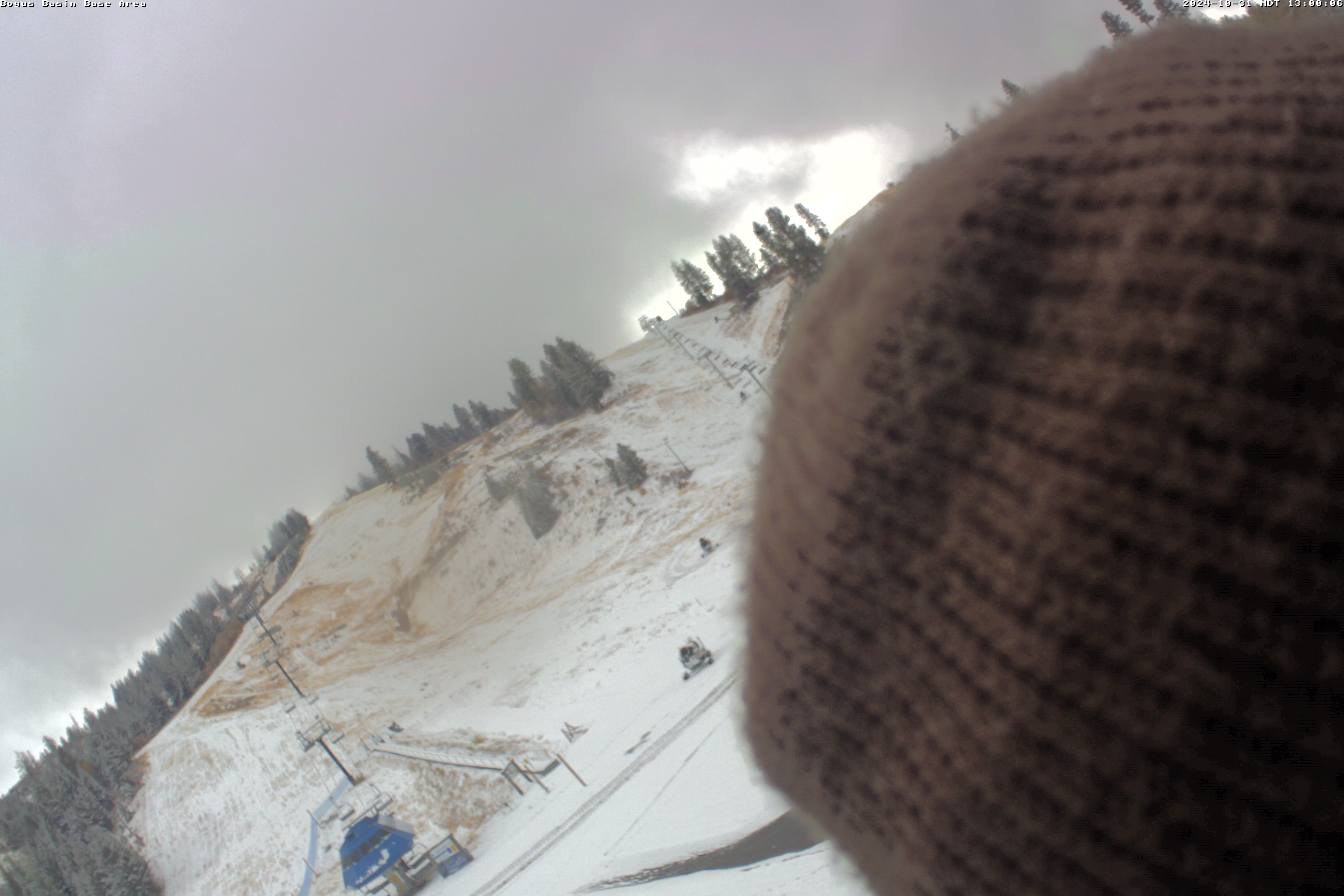
Base Area
Snow Stake
WEDNESDAY
Feb 4
46° / 30°

5 - 12
mph
 0
0
THURSDAY
Feb 5
48° / 33°
6 - 14
mph
0
FRIDAY
Feb 6

46° / 32°
6 - 14
mph
0
SATURDAY
Feb 7
44° / 33°
5 - 12
mph
0
SUNDAY
Feb 8

43° / 23°

16 - 27
mph
2
MONDAY
Feb 9

26° / 21°
8 - 16
mph
1
TUESDAY
Feb 10

31° / 25°
8 - 16
mph
0
Clear and milder, with high pressure ridging overhead.
No snow.
No precipitation expected.
Hi: 46°Low: 30°
10,698 feet to 11995 feet
Winds variable at 4 to 11 mph through the day, becoming variable at 5 to 12 mph overnight.
Mostly cloudy becoming mostly clear at times and then partly cloudy overnight. Expect windy conditions at times.
No snow.
No precipitation expected.
Hi: 45°Low: 42°
10,698 feet to 11995 feet
Winds variable at 7 to 15 mph in the morning, becoming variable at 4 to 12 mph in the afternoon, and then E at 6 to 14 mph overnight.
Clear and mild, high pressure ridge holds. Next week, on track, Feb 9-10 mainly we see a major pattern shift back to unsettled across the western US, and this pattern should hold for most of February (large scale pattern shift, east coast ridge-west coast trough). Monday-Tuesday 9-10 Feb possible snow, late next week stronger storms...
No snow.
No precipitation expected.
Hi: 48°Low: 33°
10,487 feet to 11876 feet
Winds variable at 5 to 12 mph in the morning, becoming variable at 4 to 12 mph in the afternoon through overnight.
Mostly clear becoming clear in the late morning continuing through overnight, with windy conditions at times.
No snow.
No precipitation expected.
Hi: 45°Low: 40°
10,487 feet to 11876 feet
Winds SE at 9 to 17 mph in the morning, becoming S at 8 to 16 mph in the afternoon through overnight.
Partly cloudy and mild with light winds. High pressure ridging weakens (weak closed-low to south).
No snow.
No precipitation expected.
Hi: 46°Low: 32°
8,214 feet to 10133 feet
Winds variable at 4 to 11 mph in the morning, becoming variable at 4 to 12 mph in the afternoon through overnight.
Mostly clear becoming partly cloudy at times continuing through overnight, with windy conditions at times.
No snow.
No precipitation expected.
Hi: 39°Low: 34°
8,214 feet to 10133 feet
Winds variable at 5 to 13 mph in the morning, becoming SW at 9 to 17 mph in the afternoon, and then W at 10 to 19 mph overnight.
Partly cloudy and mild with mostly light winds. High pressure ridging weakens (weak closed-low to south).
No snow.
No precipitation expected.
Hi: 44°Low: 33°
8,187 feet to 8930 feet
Winds variable at 4 to 12 mph in the morning, becoming variable at 4 to 11 mph in the afternoon, and then S at 6 to 14 mph overnight.
Partly cloudy becoming mostly clear at times and then partly cloudy overnight. Expect windy conditions at times.
No snow.
No precipitation expected.
Hi: 36°Low: 34°
8,187 feet to 8930 feet
Winds NW at 10 to 18 mph in the morning, becoming variable at 7 to 15 mph in the afternoon, and then SW at 11 to 20 mph overnight.
Mostly clear becoming cloudy in the afternoon continuing through overnight, with periods of snow expected overnight. (Next week, on track, Feb 9-10 mainly we see a major pattern shift back to unsettled across the western US, and this pattern should hold for most of February (large scale pattern shift, east coast ridge-west coast trough). Monday-Tuesday 9-10 Feb possible snow, late next week stronger storms...)
Periods of light to moderate snow overnight. Snowfall is forecast to be 2 to 4 inches.
Potential Precip:
0.07 to 0.36, 60% chance overnight
Hi: 45°Low: 27°
4,654 feet to 9195 feet
Winds variable at 13 to 22 mph with gusts to 31 through the day, becoming NW at 12 to 21 mph overnight.
Partly cloudy through the day and overnight, with periods of snow developing in the afternoon through overnight.
Periods of moderate to heavy snow throughout the day, light at times overnight. Snowfall is forecast to be 3 to 5 inches.
Potential Precip:
0.07 to 0.36
Hi: 38°Low: 18°
4,654 feet to 9195 feet
Winds SW at 21 to 32 mph through the day, becoming NW at 18 to 29 mph overnight.
Mostly cloudy to cloudy and much colder, with scattered snow showers through the morning mainly but lingering to afternoon.
Periods of snow. Snowfall is forecast to be 1 to 2 inches.
Potential Precip:
0.06 to 0.26, 60% chance
Hi: 26°Low: 21°
4,498 feet to 5386 feet
Winds NW at 7 to 15 mph through the day, becoming variable at 5 to 13 mph overnight.
Mostly clear becoming cloudy at times continuing through overnight.
Periods of snow throughout the day and overnight.
Potential Precip:
0 to 0.01
Hi: 24°Low: 20°
4,498 feet to 5386 feet
Winds NW at 8 to 16 mph through the day, becoming E at 8 to 16 mph overnight.
Cloudy through the day and overnight, with periods of snow expected overnight.
Periods of light snow overnight. Snowfall is forecast to be a trace amount.
Potential Precip:
0 to 0.02
Hi: 34°Low: 27°
4,332 feet to 6364 feet
Winds variable at 5 to 13 mph through the day, becoming variable at 4 to 12 mph overnight.
Cloudy through the day and overnight, with periods of snow expected overnight.
Periods of light snow overnight. Snowfall is forecast to be a trace amount.
Potential Precip:
0 to 0.02
Hi: 27°Low: 23°
4,332 feet to 6364 feet
Winds SE at 11 to 20 mph through the day, becoming SE at 9 to 18 mph overnight.
 Sunrise & Sunset

Lunar Calendar


 Snow Maps and Weather Stations in the Area
 ![]() 12 - 15in, past 6 days. Snow surface is packed powder and machine groomed
12 - 15in, past 6 days. Snow surface is packed powder and machine groomed
Snow report provided by SnoCountry
Plan your future trip using our temperature, snowfall, snow depth, and precipitation tool
 Day |
 High Temperatures |
 Low Temperatures |
 Precipitation |
 Snowfall |
 Snow Depth |
||||||||||||||
|---|---|---|---|---|---|---|---|---|---|---|---|---|---|---|---|---|---|---|---|
| Avg | High | Year | Low | Year | Avg | High | Year | Low | Year | Avg | Max | Year | Avg | Max | Year | Avg | Max | Year | |
| 1 | 29 | 48 | 1962 | 11 | 1956 | 14 | 24 | 1961 | -3 | 1956 | 0.171 | 1.60 | 1963 | 1.53 | 13.0 | 1963 | 40.1 | 60 | 1970 |
| 2 | 28 | 51 | 1962 | 15 | 1969 | 14 | 26 | 1963 | 4 | 1956 | 0.098 | 0.59 | 1960 | 1.50 | 9.0 | 1963 | 42.9 | 66 | 1965 |
| 3 | 29 | 45 | 1962 | 16 | 1957 | 17 | 31 | 1962 | -4 | 1969 | 0.053 | 0.35 | 1963 | 0.54 | 6.0 | 1957 | 41.5 | 66 | 1965 |
| 4 | 31 | 44 | 1963 | 18 | 1957 | 18 | 31 | 1963 | -7 | 1969 | 0.024 | 0.25 | 1959 | 0.08 | 1.0 | 1958 | 40.8 | 63 | 1965 |
| 5 | 33 | 50 | 1963 | 19 | 1955 | 18 | 29 | 1963 | 7 | 1968 | 0.017 | 0.11 | 1958 | 0.22 | 2.0 | 1958 | 38.9 | 63 | 1965 |
| 6 | 32 | 48 | 1963 | 18 | 1955 | 21 | 41 | 1963 | 10 | 1955 | 0.017 | 0.17 | 1966 | 0.08 | 0.5 | 1962 | 38.9 | 63 | 1965 |
| 7 | 32 | 50 | 1963 | 23 | 1966 | 21 | 38 | 1963 | 10 | 1965 | 0.064 | 0.35 | 1960 | 0.93 | 8.0 | 1966 | 40.8 | 62 | 1965 |
| 8 | 30 | 51 | 1963 | 16 | 1959 | 20 | 31 | 1963 | 11 | 1959 | 0.059 | 0.43 | 1960 | 0.69 | 4.0 | 1960 | 40.6 | 62 | 1965 |
| 9 | 31 | 46 | 1968 | 18 | 1966 | 20 | 33 | 1968 | 5 | 1955 | 0.119 | 0.40 | 1964 | 1.23 | 4.0 | 1965 | 42.0 | 66 | 1965 |
| 10 | 30 | 45 | 1968 | 14 | 1965 | 20 | 33 | 1961 | 3 | 1965 | 0.100 | 0.43 | 1958 | 1.12 | 6.0 | 1966 | 42.0 | 64 | 1965 |
| 11 | 30 | 43 | 1961 | 15 | 1965 | 18 | 33 | 1970 | 5 | 1965 | 0.052 | 0.22 | 1959 | 0.54 | 2.0 | 1959 | 41.2 | 62 | 1965 |
| 12 | 30 | 43 | 1957 | 21 | 1964 | 17 | 27 | 1970 | 9 | 1964 | 0.082 | 0.37 | 1956 | 2.25 | 21.0 | 1956 | 42.5 | 71 | 1956 |
| 13 | 27 | 38 | 1957 | 13 | 1966 | 17 | 28 | 1970 | 6 | 1969 | 0.120 | 0.62 | 1958 | 1.23 | 4.0 | 1964 | 42.7 | 73 | 1956 |
| 14 | 27 | 39 | 1955 | 17 | 1956 | 15 | 28 | 1957 | 5 | 1969 | 0.064 | 0.20 | 1966 | 0.58 | 2.0 | 1965 | 43.5 | 73 | 1956 |
| 15 | 28 | 44 | 1957 | 12 | 1956 | 17 | 27 | 1970 | -2 | 1956 | 0.095 | 0.43 | 1958 | 1.42 | 6.0 | 1956 | 45.3 | 79 | 1956 |
| 16 | 28 | 44 | 1970 | 6 | 1956 | 14 | 31 | 1958 | -13 | 1956 | 0.065 | 0.34 | 1958 | 0.39 | 2.0 | 1962 | 45.1 | 75 | 1956 |
| 17 | 31 | 46 | 1957 | 17 | 1956 | 16 | 32 | 1958 | -7 | 1956 | 0.070 | 0.45 | 1970 | 0.65 | 3.0 | 1970 | 45.7 | 73 | 1956 |
| 18 | 30 | 50 | 1965 | 12 | 1955 | 18 | 31 | 1958 | 1 | 1955 | 0.050 | 0.40 | 1963 | 0.46 | 3.0 | 1963 | 46.3 | 73 | 1956 |
| 19 | 30 | 43 | 1958 | 13 | 1955 | 20 | 34 | 1958 | 4 | 1955 | 0.060 | 0.40 | 1963 | 0.35 | 2.5 | 1961 | 44.8 | 72 | 1956 |
| 20 | 31 | 41 | 1965 | 19 | 1955 | 20 | 33 | 1958 | 6 | 1955 | 0.051 | 0.55 | 1957 | 0.50 | 6.0 | 1957 | 44.0 | 72 | 1956 |
| 21 | 31 | 41 | 1958 | 19 | 1955 | 21 | 34 | 1958 | 7 | 1957 | 0.012 | 0.10 | 1957 | 0.23 | 2.0 | 1969 | 42.3 | 70 | 1956 |
| 22 | 32 | 43 | 1970 | 19 | 1960 | 19 | 36 | 1958 | -6 | 1966 | 0.017 | 0.13 | 1957 | 0.34 | 3.0 | 1968 | 41.7 | 69 | 1956 |
| 23 | 30 | 47 | 1970 | 19 | 1962 | 20 | 31 | 1958 | 8 | 1960 | 0.078 | 0.57 | 1968 | 0.38 | 3.0 | 1957 | 41.9 | 68 | 1956 |
| 24 | 30 | 50 | 1970 | 16 | 1962 | 19 | 30 | 1967 | 8 | 1962 | 0.022 | 0.12 | 1964 | 0.32 | 2.0 | 1955 | 41.2 | 68 | 1956 |
| 25 | 30 | 47 | 1968 | 10 | 1962 | 18 | 31 | 1963 | -3 | 1962 | 0.145 | 1.08 | 1955 | 1.21 | 6.0 | 1955 | 44.1 | 69 | 1956 |
| 26 | 28 | 51 | 1968 | 4 | 1962 | 17 | 34 | 1968 | -7 | 1962 | 0.110 | 0.70 | 1963 | 0.96 | 4.0 | 1966 | 46.5 | 70 | 1956 |
| 27 | 27 | 50 | 1968 | 3 | 1962 | 15 | 39 | 1968 | -9 | 1962 | 0.031 | 0.14 | 1955 | 0.43 | 2.0 | 1958 | 44.9 | 71 | 1956 |
| 28 | 28 | 48 | 1968 | 11 | 1962 | 16 | 39 | 1968 | -4 | 1960 | 0.010 | 0.05 | 1966 | 0.39 | 3.0 | 1955 | 44.7 | 70 | 1956 |
Day |
High Temperatures |
Low Temperatures |
Precipitation |
Snowfall |
Snow Depth |
||||||||||||||
|---|---|---|---|---|---|---|---|---|---|---|---|---|---|---|---|---|---|---|---|
| Avg | High | Year | Low | Year | Avg | High | Year | Low | Year | Avg | Max | Year | Avg | Max | Year | Avg | Max | Year | |
| 1 | 29 | 48 | 1962 | 11 | 1956 | 14 | 24 | 1961 | -3 | 1956 | 0.171 | 1.60 | 1963 | 1.53 | 13.0 | 1963 | 40.1 | 60 | 1970 |
| 2 | 28 | 51 | 1962 | 15 | 1969 | 14 | 26 | 1963 | 4 | 1956 | 0.098 | 0.59 | 1960 | 1.50 | 9.0 | 1963 | 42.9 | 66 | 1965 |
| 3 | 29 | 45 | 1962 | 16 | 1957 | 17 | 31 | 1962 | -4 | 1969 | 0.053 | 0.35 | 1963 | 0.54 | 6.0 | 1957 | 41.5 | 66 | 1965 |
| 4 | 31 | 44 | 1963 | 18 | 1957 | 18 | 31 | 1963 | -7 | 1969 | 0.024 | 0.25 | 1959 | 0.08 | 1.0 | 1958 | 40.8 | 63 | 1965 |
| 5 | 33 | 50 | 1963 | 19 | 1955 | 18 | 29 | 1963 | 7 | 1968 | 0.017 | 0.11 | 1958 | 0.22 | 2.0 | 1958 | 38.9 | 63 | 1965 |
| 6 | 32 | 48 | 1963 | 18 | 1955 | 21 | 41 | 1963 | 10 | 1955 | 0.017 | 0.17 | 1966 | 0.08 | 0.5 | 1962 | 38.9 | 63 | 1965 |
| 7 | 32 | 50 | 1963 | 23 | 1966 | 21 | 38 | 1963 | 10 | 1965 | 0.064 | 0.35 | 1960 | 0.93 | 8.0 | 1966 | 40.8 | 62 | 1965 |
| 8 | 30 | 51 | 1963 | 16 | 1959 | 20 | 31 | 1963 | 11 | 1959 | 0.059 | 0.43 | 1960 | 0.69 | 4.0 | 1960 | 40.6 | 62 | 1965 |
| 9 | 31 | 46 | 1968 | 18 | 1966 | 20 | 33 | 1968 | 5 | 1955 | 0.119 | 0.40 | 1964 | 1.23 | 4.0 | 1965 | 42.0 | 66 | 1965 |
| 10 | 30 | 45 | 1968 | 14 | 1965 | 20 | 33 | 1961 | 3 | 1965 | 0.100 | 0.43 | 1958 | 1.12 | 6.0 | 1966 | 42.0 | 64 | 1965 |
| 11 | 30 | 43 | 1961 | 15 | 1965 | 18 | 33 | 1970 | 5 | 1965 | 0.052 | 0.22 | 1959 | 0.54 | 2.0 | 1959 | 41.2 | 62 | 1965 |
| 12 | 30 | 43 | 1957 | 21 | 1964 | 17 | 27 | 1970 | 9 | 1964 | 0.082 | 0.37 | 1956 | 2.25 | 21.0 | 1956 | 42.5 | 71 | 1956 |
| 13 | 27 | 38 | 1957 | 13 | 1966 | 17 | 28 | 1970 | 6 | 1969 | 0.120 | 0.62 | 1958 | 1.23 | 4.0 | 1964 | 42.7 | 73 | 1956 |
| 14 | 27 | 39 | 1955 | 17 | 1956 | 15 | 28 | 1957 | 5 | 1969 | 0.064 | 0.20 | 1966 | 0.58 | 2.0 | 1965 | 43.5 | 73 | 1956 |
| 15 | 28 | 44 | 1957 | 12 | 1956 | 17 | 27 | 1970 | -2 | 1956 | 0.095 | 0.43 | 1958 | 1.42 | 6.0 | 1956 | 45.3 | 79 | 1956 |
| 16 | 28 | 44 | 1970 | 6 | 1956 | 14 | 31 | 1958 | -13 | 1956 | 0.065 | 0.34 | 1958 | 0.39 | 2.0 | 1962 | 45.1 | 75 | 1956 |
| 17 | 31 | 46 | 1957 | 17 | 1956 | 16 | 32 | 1958 | -7 | 1956 | 0.070 | 0.45 | 1970 | 0.65 | 3.0 | 1970 | 45.7 | 73 | 1956 |
| 18 | 30 | 50 | 1965 | 12 | 1955 | 18 | 31 | 1958 | 1 | 1955 | 0.050 | 0.40 | 1963 | 0.46 | 3.0 | 1963 | 46.3 | 73 | 1956 |
| 19 | 30 | 43 | 1958 | 13 | 1955 | 20 | 34 | 1958 | 4 | 1955 | 0.060 | 0.40 | 1963 | 0.35 | 2.5 | 1961 | 44.8 | 72 | 1956 |
| 20 | 31 | 41 | 1965 | 19 | 1955 | 20 | 33 | 1958 | 6 | 1955 | 0.051 | 0.55 | 1957 | 0.50 | 6.0 | 1957 | 44.0 | 72 | 1956 |
| 21 | 31 | 41 | 1958 | 19 | 1955 | 21 | 34 | 1958 | 7 | 1957 | 0.012 | 0.10 | 1957 | 0.23 | 2.0 | 1969 | 42.3 | 70 | 1956 |
| 22 | 32 | 43 | 1970 | 19 | 1960 | 19 | 36 | 1958 | -6 | 1966 | 0.017 | 0.13 | 1957 | 0.34 | 3.0 | 1968 | 41.7 | 69 | 1956 |
| 23 | 30 | 47 | 1970 | 19 | 1962 | 20 | 31 | 1958 | 8 | 1960 | 0.078 | 0.57 | 1968 | 0.38 | 3.0 | 1957 | 41.9 | 68 | 1956 |
| 24 | 30 | 50 | 1970 | 16 | 1962 | 19 | 30 | 1967 | 8 | 1962 | 0.022 | 0.12 | 1964 | 0.32 | 2.0 | 1955 | 41.2 | 68 | 1956 |
| 25 | 30 | 47 | 1968 | 10 | 1962 | 18 | 31 | 1963 | -3 | 1962 | 0.145 | 1.08 | 1955 | 1.21 | 6.0 | 1955 | 44.1 | 69 | 1956 |
| 26 | 28 | 51 | 1968 | 4 | 1962 | 17 | 34 | 1968 | -7 | 1962 | 0.110 | 0.70 | 1963 | 0.96 | 4.0 | 1966 | 46.5 | 70 | 1956 |
| 27 | 27 | 50 | 1968 | 3 | 1962 | 15 | 39 | 1968 | -9 | 1962 | 0.031 | 0.14 | 1955 | 0.43 | 2.0 | 1958 | 44.9 | 71 | 1956 |
| 28 | 28 | 48 | 1968 | 11 | 1962 | 16 | 39 | 1968 | -4 | 1960 | 0.010 | 0.05 | 1966 | 0.39 | 3.0 | 1955 | 44.7 | 70 | 1956 |
 Mountain Base


