 Mt Waterman
 Revelstoke Mountain Resort
  WebCams

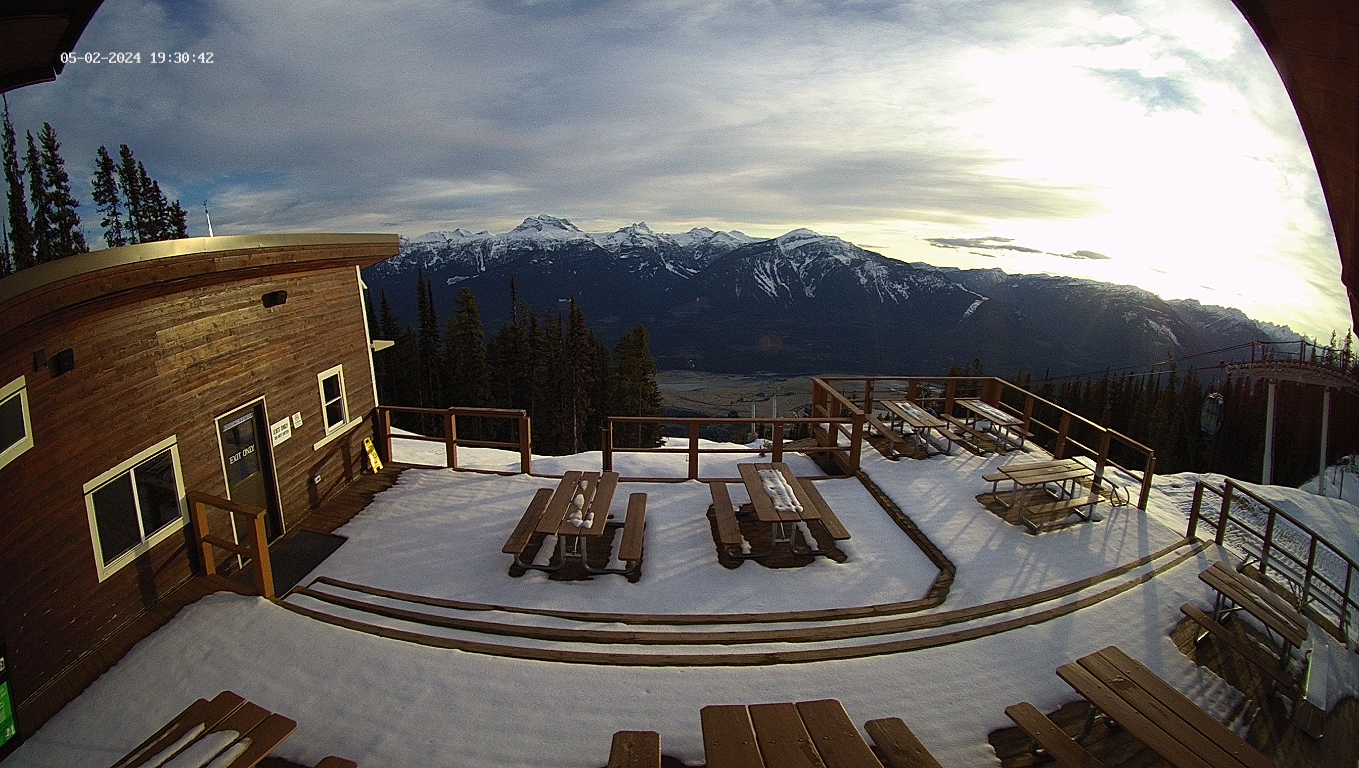
Top of the Stoke
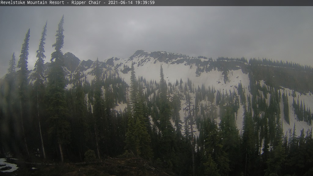
Ripper
Mackenzie Outpost
TUESDAY
May 5

35° / 19°

5 - 12
mph
 0
0
WEDNESDAY
May 6

35° / 31°
5 - 13
mph
2
THURSDAY
May 7
37° / 32°
6 - 14
mph
4
FRIDAY
May 8

36° / 7°
5 - 12
mph
3
SATURDAY
May 9

31° / 8°
5 - 12
mph
0
SUNDAY
May 10
35° / 23°

3 - 11
mph
0
MONDAY
May 11
37° / 27°
3 - 11
mph
1
Partly cloudy becoming mostly cloudy overnight continuing through overnight, with periods of snow expected in the morning through overnight.
Snowfall is forecast to be a trace amount during the day, and a trace amount overnight.
Potential Precip:
0.01 to 0.03
Hi: 39°Low: 23°
0 feet to 3785 feet
Winds variable at 4 to 11 mph in the morning, becoming variable at 5 to 12 mph in the afternoon through overnight.
Partly cloudy becoming mostly cloudy overnight continuing through overnight, with periods of snow expected in the morning through overnight.
Snowfall is forecast to be a trace amount during the day, and a trace amount overnight.
Potential Precip:
0.01 to 0.03
Hi: 18°Low: 14°
0 feet to 3785 feet
Winds variable at 5 to 13 mph in the morning, becoming SW at 6 to 14 mph in the afternoon, and then SW at 7 to 15 mph overnight.
Cloudy through the day and overnight, with periods of snow expected at any time.
Light snow through the day and into overnight. Snowfall is forecast to be a trace amount during the day, and a trace amount in the evening and overnight.
Potential Precip:
0.14 to 0.68
Hi: 39°Low: 35°
2,624 feet to 3688 feet
Winds variable at 5 to 13 mph through the day, becoming S at 6 to 14 mph overnight.
Cloudy through the day and overnight, with periods of snow expected at any time.
Moderate snow through the day into the evening with periods of heavy during the day, becoming heavy overnight. Snowfall is forecast to be 3 to 5 during the day, and 3 to 6 inches in the evening and overnight.
Potential Precip:
0.14 to 0.68
Hi: 18°Low: 16°
2,624 feet to 3688 feet
Winds SW at 9 to 17 mph in the morning, becoming SW at 11 to 20 mph in the afternoon, and then SW at 13 to 22 mph overnight.
Cloudy through the day and overnight, with periods of rain and snow expected overnight.
Light snow in the evening through overnight. Snowfall is forecast to be a trace amount in the evening and overnight.
Potential Precip:
0.43 to 2.15
Hi: 41°Low: 37°
2,988 feet to 4345 feet
Winds S at 7 to 15 mph in the morning, becoming SW at 6 to 14 mph in the afternoon, and then variable at 5 to 13 mph overnight.
Cloudy through the day and overnight, with periods of snow expected at any time.
Heavy snow through the day and into overnight. Snowfall is forecast to be 9 to 13 during the day, and 8 to 12 inches in the evening and overnight.
Potential Precip:
0.43 to 2.15
Hi: 21°Low: 18°
2,988 feet to 4345 feet
Winds SW at 14 to 23 mph in the morning, becoming SW at 13 to 22 mph in the afternoon, and then SW at 10 to 19 mph overnight.
Cloudy becoming mostly cloudy at times and then mostly clear overnight. Periods of rain and snow are expected overnight.
Periods of light to moderate snow throughout the day, light at times overnight. Snowfall is forecast to be 1 to 2 inches.
Potential Precip:
0.18 to 0.92
Hi: 40°Low: 11°
0 feet to 4054 feet
Winds variable at 5 to 13 mph in the morning, becoming variable at 5 to 12 mph in the afternoon through overnight.
Cloudy becoming mostly cloudy at times and then mostly clear overnight. Periods of snow are expected in the morning through overnight.
Periods of heavy snow throughout the day, light at times overnight. Snowfall is forecast to be 7 to 11 inches.
Potential Precip:
0.18 to 0.92
Hi: 19°Low: 10°
0 feet to 4054 feet
Winds SW at 10 to 18 mph in the morning, becoming W at 10 to 18 mph in the afternoon, and then W at 6 to 14 mph overnight.
Mostly clear becoming clear at times continuing through overnight.
Periods of snow throughout the day and overnight.
Potential Precip:
0 to 0.01
Hi: 35°Low: 12°
0 feet to 2618 feet
Winds variable at 5 to 12 mph throughout the day and into overnight.
Mostly clear becoming clear at times continuing through overnight.
Periods of snow throughout the day and overnight.
Potential Precip:
0 to 0.01
Hi: 20°Low: 14°
0 feet to 2618 feet
Winds variable at 4 to 12 mph through the day, becoming SW at 6 to 14 mph overnight.
Mostly clear becoming partly cloudy in the late morning continuing through overnight, with periods of snow developing in the afternoon through overnight.
Periods of light snow throughout the day and overnight. Snowfall is forecast to be a trace amount.
Potential Precip:
0 to 0.02
Hi: 39°Low: 27°
0 feet to 3809 feet
Winds variable at 3 to 11 mph through the day, becoming variable at 5 to 12 mph overnight.
Mostly clear becoming partly cloudy in the late morning continuing through overnight, with periods of snow developing in the afternoon through overnight.
Periods of light snow throughout the day and overnight. Snowfall is forecast to be a trace amount.
Potential Precip:
0 to 0.02
Hi: 23°Low: 20°
0 feet to 3809 feet
Winds SW at 8 to 16 mph throughout the day and into overnight.
Mostly cloudy becoming partly cloudy overnight continuing through overnight, with periods of rain and snow expected overnight.
Periods of light snow throughout the day and overnight. Snowfall is forecast to be a trace amount.
Potential Precip:
0.02 to 0.11
Hi: 42°Low: 31°
1,397 feet to 4460 feet
Winds variable at 3 to 11 mph through the day, becoming variable at 5 to 12 mph overnight.
Mostly cloudy becoming partly cloudy overnight continuing through overnight, with periods of snow expected at any time.
Periods of light snow throughout the day and overnight. Snowfall is forecast to be 1 to 2 inches.
Potential Precip:
0.02 to 0.11
Hi: 24°Low: 21°
1,397 feet to 4460 feet
Winds SW at 8 to 16 mph throughout the day and into overnight.
 Sunrise & Sunset

Lunar Calendar


 Snow Maps and Weather Stations in the Area
 ![]() 33in, past 7 days. Snow surface is powder and packed powder
33in, past 7 days. Snow surface is powder and packed powder
Snow report provided by SnoCountry
 Mountain Base


