 Molltaler Gl...
 Revelstoke Mountain Resort
  WebCams

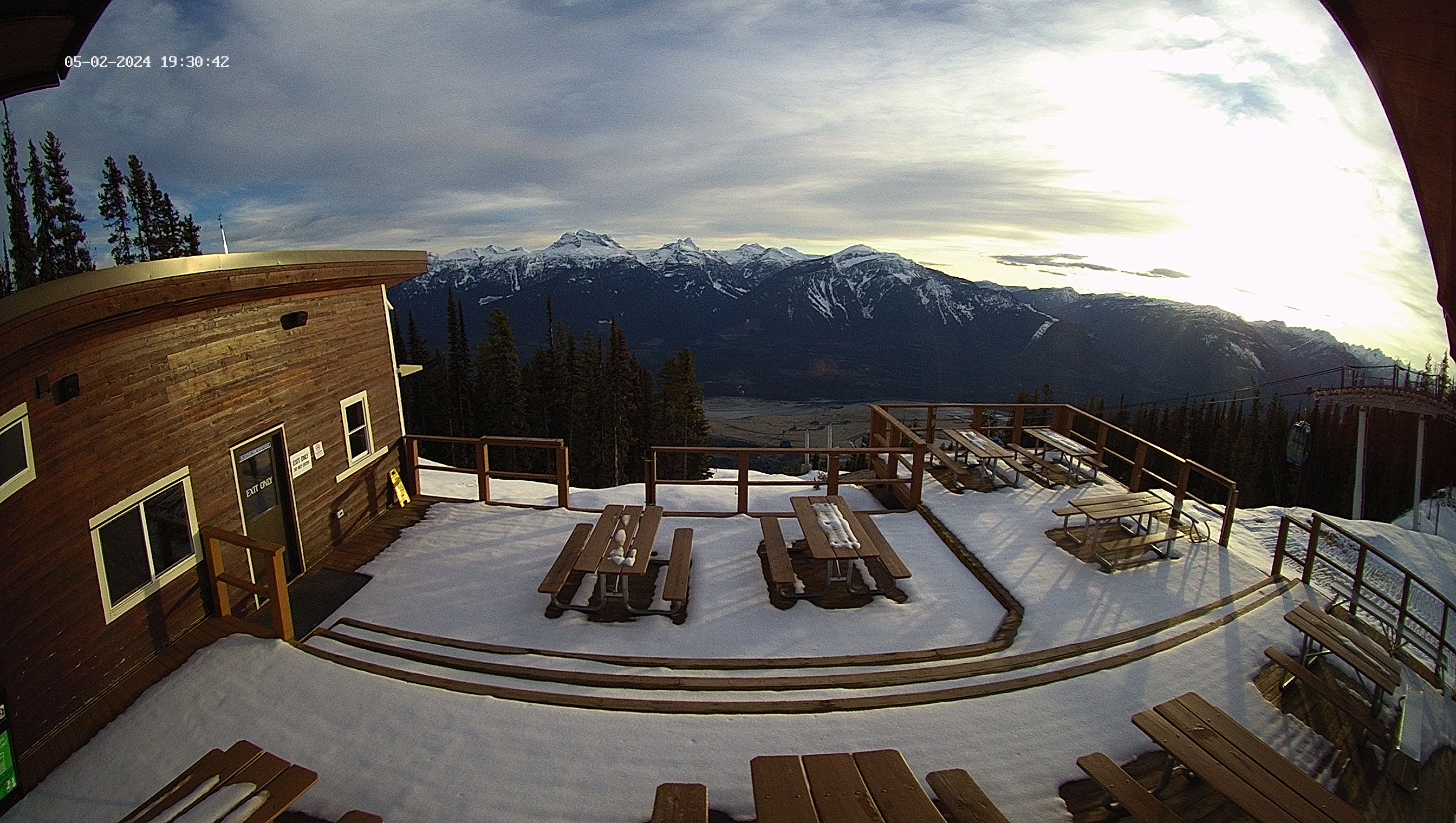
Top of the Stoke
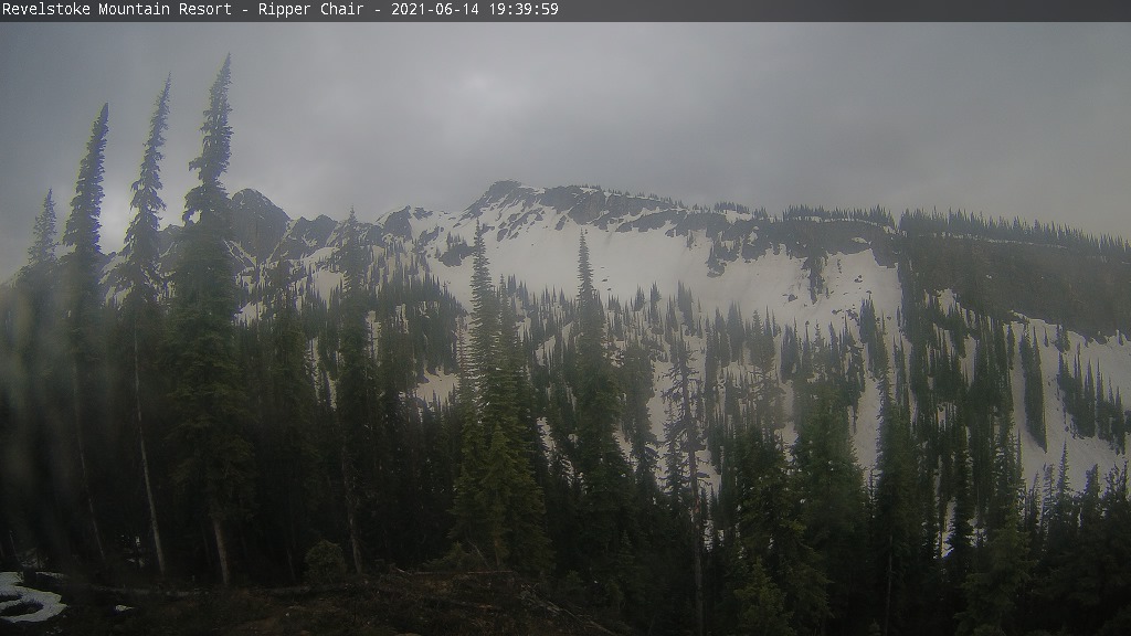
Ripper
Mackenzie Outpost
WEDNESDAY
Oct 23

46° / 31°

0 - 0
mph
 0
0
THURSDAY
Oct 24
43° / 33°
0 - 0
mph
0
FRIDAY
Oct 25

46° / 37°

5 - 12
mph
0
SATURDAY
Oct 26

45° / 38°
5 - 12
mph
0
SUNDAY
Oct 27

42° / 41°
4 - 11
mph
0
MONDAY
Oct 28
40° / 28°
5 - 12
mph
0
TUESDAY
Oct 29
37° / 25°
5 - 12
mph
0
Mostly clear through the day becoming partly cloudy overnight.
Light snow in the evening. Snowfall is forecast to be a trace amount in the evening.
Potential Precip:
0 to 0.01
Hi: 51°Low: 35°
2,535 feet to 6385 feet
Winds variable at 5 to 12 mph in the morning, becoming calm in the afternoon, and then variable at 4 to 11 mph overnight.
Mostly clear through the day becoming partly cloudy overnight. Periods of snow are expected in the evening.
Light snow in the evening. Snowfall is forecast to be a trace amount in the evening.
Potential Precip:
0 to 0.01
Hi: 27°Low: 19°
2,535 feet to 6385 feet
Winds SW at 6 to 14 mph throughout the day and into overnight.
Partly cloudy becoming mostly clear in the afternoon and then partly cloudy overnight.
No snow.
Potential Precip:
0 to 0.01
Hi: 47°Low: 37°
3,112 feet to 6092 feet
Winds variable at 4 to 11 mph in the morning, becoming calm in the afternoon, and then variable at 4 to 11 mph overnight.
Partly cloudy becoming mostly clear in the afternoon and then partly cloudy overnight.
Periods of light snow during the day. Snowfall is forecast to be a trace amount during the day.
Potential Precip:
0 to 0.01
Hi: 27°Low: 22°
3,112 feet to 6092 feet
Winds variable at 5 to 13 mph throughout the day and into overnight.
Mostly cloudy becoming cloudy in the afternoon continuing through overnight, with periods of rain developing in the evening through overnight.
No snow.
Potential Precip:
0.03 to 0.14
Hi: 51°Low: 42°
4,443 feet to 9212 feet
Winds variable at 5 to 12 mph through the day, becoming variable at 4 to 12 mph overnight.
Mostly cloudy becoming cloudy in the afternoon continuing through overnight, with periods of snow developing in the evening through overnight.
Light snow in the evening and overnight with periods of moderate overnight. Snowfall is forecast to be 1 to 2 inches in the evening and overnight.
Potential Precip:
0.03 to 0.14
Hi: 37°Low: 30°
4,443 feet to 9212 feet
Winds SE at 7 to 15 mph in the morning, becoming S at 10 to 18 mph in the afternoon, and then S at 11 to 20 mph overnight.
Mostly cloudy through the day and overnight, with periods of rain expected in the morning through overnight.
No snow.
Potential Precip:
0 to 0.02
Hi: 49°Low: 43°
4,900 feet to 8429 feet
Winds variable at 4 to 12 mph in the morning, becoming variable at 5 to 12 mph in the afternoon through overnight.
Mostly cloudy through the day and overnight, with periods of snow expected in the morning through overnight.
Periods of light snow throughout the day and overnight. Snowfall is forecast to be a trace amount.
Potential Precip:
0 to 0.02
Hi: 34°Low: 32°
4,900 feet to 8429 feet
Winds S at 10 to 19 mph through the day, becoming S at 7 to 15 mph overnight.
Cloudy through the day and overnight, with periods of rain expected at any time.
No snow.
Potential Precip:
0.23 to 1.17
Hi: 47°Low: 46°
5,549 feet to 6554 feet
Winds variable at 4 to 11 mph through the day, becoming variable at 5 to 12 mph overnight.
Cloudy through the day and overnight, with periods of snow expected at any time.
Periods of moderate snow throughout the day and overnight. Snowfall is forecast to be 5 to 8 inches.
Potential Precip:
0.23 to 1.17
Hi: 31°Low: 26°
5,549 feet to 6554 feet
Winds SW at 6 to 14 mph through the day, becoming SW at 7 to 15 mph overnight.
Mostly cloudy becoming mostly clear at times and then mostly cloudy overnight. Periods of rain and snow are expected overnight.
Periods of light snow throughout the day and overnight. Snowfall is forecast to be a trace amount.
Potential Precip:
0.05 to 0.25
Hi: 45°Low: 33°
1,873 feet to 5155 feet
Winds variable at 5 to 12 mph throughout the day and into overnight.
Mostly cloudy becoming mostly clear at times and then mostly cloudy overnight. Periods of snow are expected at any time.
Periods of light to moderate snow throughout the day, light at times overnight. Snowfall is forecast to be 2 to 4 inches.
Potential Precip:
0.05 to 0.25
Hi: 24°Low: 18°
1,873 feet to 5155 feet
Winds NW at 6 to 14 mph through the day, becoming variable at 4 to 12 mph overnight.
Mostly cloudy becoming mostly clear in the afternoon continuing through overnight.
Periods of light snow throughout the day. Snowfall is forecast to be a trace amount.
Potential Precip:
0.01 to 0.05
Hi: 41°Low: 30°
1,009 feet to 4380 feet
Winds variable at 5 to 12 mph throughout the day and into overnight.
Mostly cloudy becoming mostly clear in the afternoon continuing through overnight, with periods of snow expected in the morning through afternoon.
Periods of light snow throughout the day. Snowfall is forecast to be a trace amount.
Potential Precip:
0.01 to 0.05
Hi: 21°Low: 18°
1,009 feet to 4380 feet
Winds variable at 4 to 12 mph through the day, becoming S at 8 to 16 mph overnight.
 Sunrise & Sunset

Lunar Calendar


advertisement

 Snow Maps and Weather Stations in the Area
 ![]() 33in, past 7 days. Snow surface is powder and packed powder
33in, past 7 days. Snow surface is powder and packed powder
Snow report provided by SnoCountry
 Mountain Base


